Close-ups
Framed and on the wall


Frame and rooms are illustrations of how the print could look, drawn to its real size; it is sold unframed unless the description says otherwise.
The Holy Land
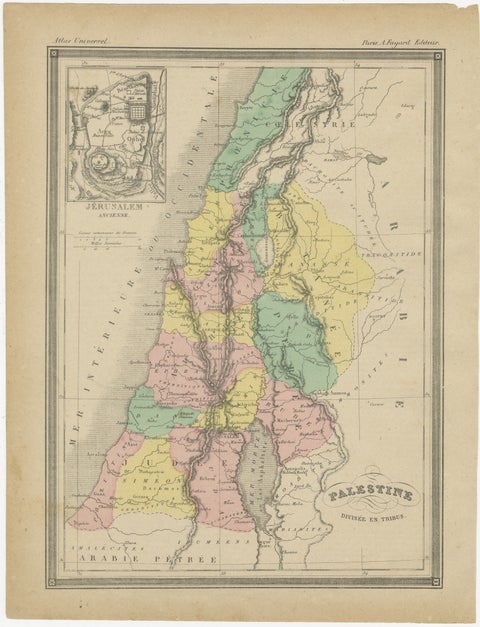
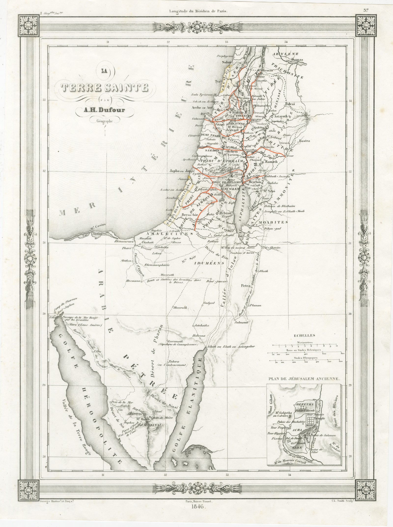
Holy Land Map, Jerusalem & Sinai, Dufour Biblical Map, Paris 1846
Anno Domini MDCCCXLVI1846
$555
€495 · £420
Original print, not a reproduction
Ships worldwide from the Netherlands, flat, insured and tracked. 14-day returns. To buy, use Ask a question (info@antiquesacredprints.com) and we will reserve it for you.
- Date
- 1846
- Sheet size
- 13 × 9.7 in (33 × 24.7 cm)
- Condition
- Good. Good overall condition with light age-related toning and occasional faint spotting, mainly in the margins. The engraved image remains clean and well-defined. The decorative border is intact and sharp. Minor edge wear consistent with age.
- Faith
- Christianity, Judaism
- Collection
- The Holy Land
- Era
- 1800 to 1849, Travellers and the costume books
- Stock no.
- f_49454662
Title: Holy Land Map, Jerusalem & Sinai, Dufour Biblical Map, Paris 1846
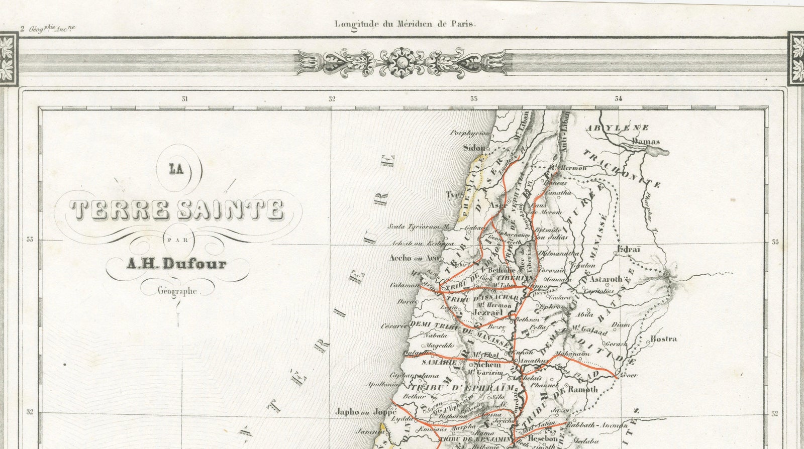
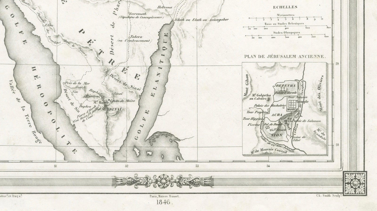
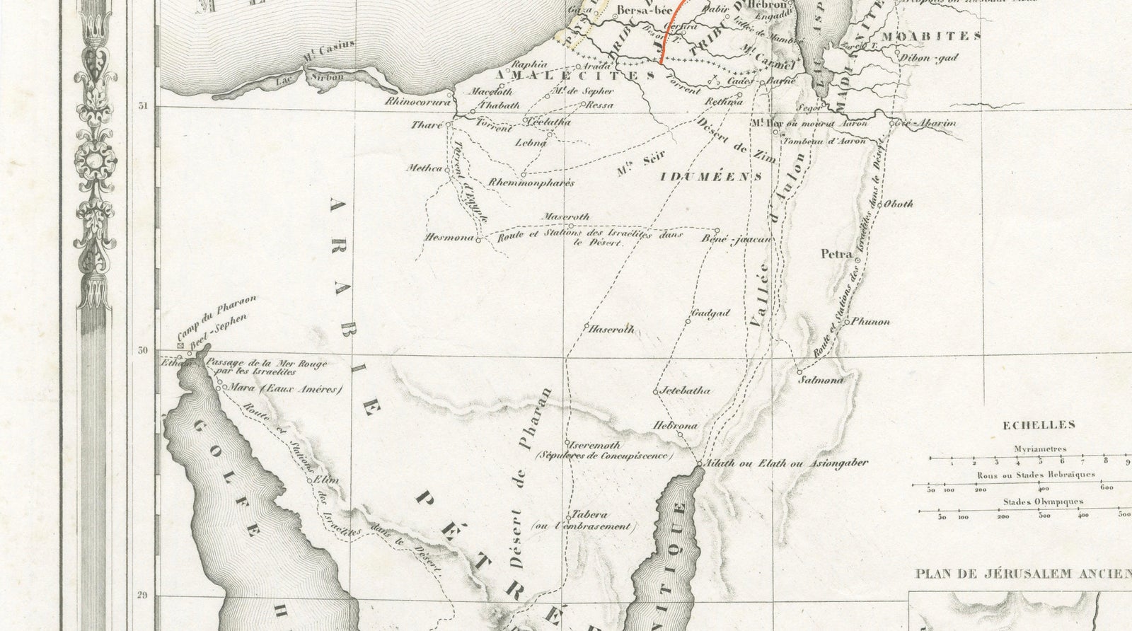
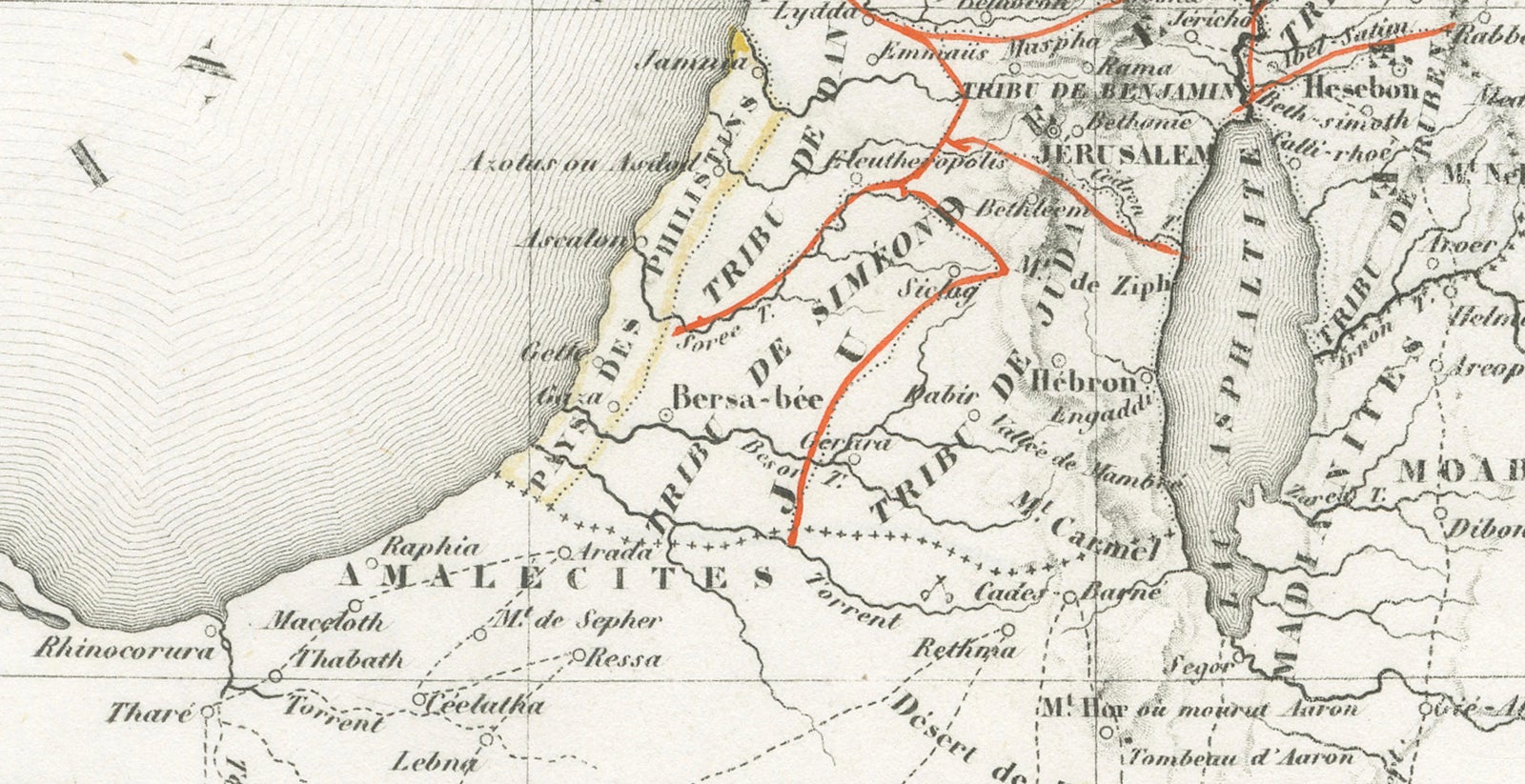
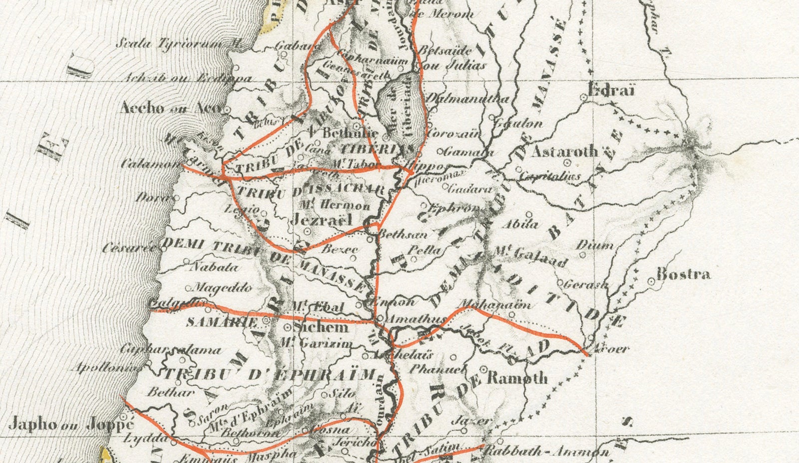
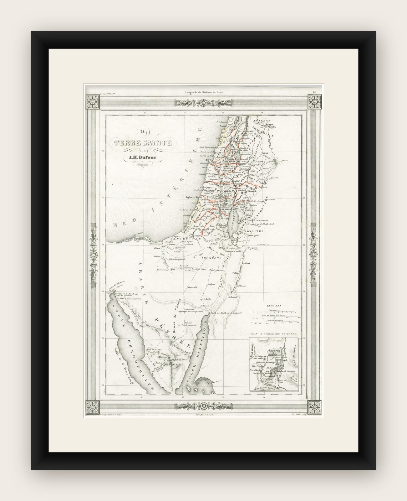
This elegant and finely engraved map of the Holy Land was created by the French geographer A.H. Dufour and published in Paris in 1846. It offers a detailed and evocative depiction of biblical Palestine, extending from Lebanon and the Levantine coast through Jerusalem and the Jordan Valley, down to the Sinai Peninsula and the Red Sea. Produced during a period of renewed European scholarly and religious interest in the geography of the Bible, this map reflects both scientific precision and devotional curiosity.
The composition is particularly appealing for its clarity and refinement. Major biblical regions and cities, Jerusalem, Bethlehem, Jericho, Nazareth, and the Dead Sea, are carefully delineated, while routes and boundaries are subtly emphasized in period hand-coloring, likely added by an early owner to highlight scriptural journeys or tribal divisions. The map also includes a detailed inset plan of ancient Jerusalem in the lower right corner, adding both historical depth and visual interest.
The decorative border is characteristic of mid-19th-century French cartography, combining classical ornamentation with a restrained, architectural elegance that enhances the presentation without overwhelming the geographic content. The engraving itself is crisp and balanced, with finely rendered coastlines, mountain ranges, and place names that remain highly legible.
This map would have served both educational and devotional purposes, making it especially attractive to collectors interested in biblical history, early travel, or 19th-century European perspectives on the Near East. Its combination of geographic scope and focused detail makes it a versatile and visually compelling piece for both collectors and interior designers.
This is an original antique engraving, not a reproduction. All items we offer are authentic period works of art over 100 years old. The map is sold unframed; any framed images are shown for presentation and interior inspiration only and may not always be to scale.
Condition: Good overall condition with light age-related toning and occasional faint spotting, mainly in the margins. The engraved image remains clean and well-defined. The decorative border is intact and sharp. Minor edge wear consistent with age.
Framing tips: This map benefits from a classic presentation, an ebonized or dark walnut frame with a wide ivory mount will emphasize the engraving and decorative border. For a lighter interior, a soft gold or bronze frame paired with a warm white mat can enhance the historical and devotional character of the piece.
Keywords: Holy Land map, Jerusalem map, biblical map, Palestine 19th century, Sinai Peninsula, Red Sea, Dead Sea, Jordan River, Bethlehem, Nazareth, antique map, Dufour, French cartography, biblical geography, Jerusalem plan, Levant map, Middle East map, religious map, Paris 1846
Technique: Steel engraving
Maker: A.H. Dufour, France, 1846
Explore